On me:
Icebug DTS2 GTX Shoes sz 15;
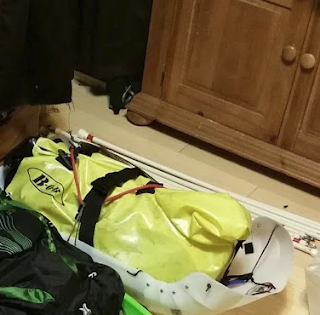
My sled and in my sled:
Weight Item
(lbs., approx)
Not bringing a stove is controversial, but I am confident that I can do it safely. I try to keep my layers at a low enough level that I don't perspire much. So I normally only need about 2 liters of water per day--one camelbak of water (plus whatever I get at the checkpoints). For segments that could potentially take two days, I just bring an extra two liters in my sled. The only place that I have ever run out of water is the Rohn to Nikolai segment, but there is a creek about 20 miles out of Nikolai called Sullivan Creek that has potable water. If it's your first time doing the race I would recommend bringing a stove.
Overflow is always a risk, but since I wear studded shoes (or studded ski boots) waders are not an option. For short overflow sections, I'll take off my shoes, put on my nighttime booties and put the compactor bags over them. That way if the bags get torn, my regular footwear will still be dry and warm. For longer overflow sections (which normally only occur in warmer conditions), I'll put the bags inside my regular foot wear but over my socks. That'll result in wet shoes, but I'll keep my socks dry by replacing the trash bags with smaller heavy duty sandwich bags after the crossing. Over time the walking action will dry my footwear naturally, but until then, if I get cold I can put hand warmers inside the bags--I have tested this and there is just enough air to allow them to work. I have tested various components of this system, but in generally I haven't encountered much overflow during the race so I am not certain how well it will work in a real-world situation.

Weight Item
5.00 Food
4.40 2 qts H2O
1.10 Hand warmers * 4
2.00 TSL Symbioz Racing Snowshoe, 8 x 21.5, White
0.25 Titanium 16 OzCup
0.35 Foot Care Bag (Nail clippers, scissors, Moleskin, Tenacious Clean Tape 3x20)
0.35 Personal bag (lots of medicine, tooth brush, etc)
0.51 Red ground cloth
1.50 Bob Dry Bag
0.40 2*dry max socks spares
5.00 -40 REI sleeping bag
1.46 Parka
2.70 Sled (From Northern Sledworks)
1.00 Puffy pants
1.32 Air Mattress (Recharge Sleeping Pad, Ultralight,) and Therm-a-Rest NeoAir Mini Pump
0.44 Gaiters
0.07 Wading Bags
0.14 Coffee & Gatorade
0.50 TPaper * 2 rolls
0.25 US Military RuffNot bringing a stove is controversial, but I am confident that I can do it safely. I try to keep my layers at a low enough level that I don't perspire much. So I normally only need about 2 liters of water per day--one camelbak of water (plus whatever I get at the checkpoints). For segments that could potentially take two days, I just bring an extra two liters in my sled. The only place that I have ever run out of water is the Rohn to Nikolai segment, but there is a creek about 20 miles out of Nikolai called Sullivan Creek that has potable water. If it's your first time doing the race I would recommend bringing a stove.
Overflow is always a risk, but since I wear studded shoes (or studded ski boots) waders are not an option. For short overflow sections, I'll take off my shoes, put on my nighttime booties and put the compactor bags over them. That way if the bags get torn, my regular footwear will still be dry and warm. For longer overflow sections (which normally only occur in warmer conditions), I'll put the bags inside my regular foot wear but over my socks. That'll result in wet shoes, but I'll keep my socks dry by replacing the trash bags with smaller heavy duty sandwich bags after the crossing. Over time the walking action will dry my footwear naturally, but until then, if I get cold I can put hand warmers inside the bags--I have tested this and there is just enough air to allow them to work. I have tested various components of this system, but in generally I haven't encountered much overflow during the race so I am not certain how well it will work in a real-world situation.


