Introduction. On February 25, 2018, I lined up for my fourth start of the Iditarod Trail Invitational. The ITI is a human-powered race from Knik, Alaska (outside of Wasilla) through the Alaska Mountain range to McGrath, Alaska. More information can be found at www.Iditarodtrailinvitational.com
The race has been conducted in one form or another for over 20 years and allows qualified entrants to race on the Iditarod Trail via skis, bike, or foot. My first two starts had been on a bike on which I’d finished in about 5 and a half days in 2015 and in about 4 days in 2016. In 2017, I made a foot effort but had to scratch after 210 miles due to intestinal illness and extreme fatigue. In that trek, I was forced to take a longer than normal route through the Alaska Range because of unusual snow conditions, but I made it through the mountains and to the Rohn checkpoint. I faced a bivouac at -30*F and strong winds over several days, but came away with the strong conviction that a finish was achievable for me if I could make it to the starting line healthy and reasonably well trained.
So, I applied for the 2018 race and began my preparation. I was comfortable with my equipment and opted for only one significant change: upgrading my sleeping bag from one rated at -20*F to one with a -40*F rating. My focus would be on running and long walks. At the peak of my training, I was running about 40 miles a week and doing a 40 mile run/walk on Sundays with full gear and my survival sled. Because of my DNF in 2017, I also wanted to add some successful racing to my training to build confidence. This included a 49k (30-miler) in August, 2017, and a loop of the Barkley course during the Barkley Fall Classic. Both of those races went well. I was slow, but I finished and felt good the whole way. With the training and race successes under my belt, I felt cautiously optimistic as the start of the 2018 ITI approached.
The race starts at 2:00 pm in Knik on the last Sunday in February, but the day begins with equipment and bus loading at about 10:30 am at the Westmark Hotel in downtown Anchorage. I had a chance to talk to a number of other racers including foot racers Scott Hoberg and Gavin Woody. Gavin and Scott were experienced ultra-marathoners. I had met Gavin about 3 years earlier at the Susitna 100 and had been following Scott’s training on Strava for months. Both seemed relaxed and strong and gave no signs of the dramatic events that would unfold in five days involving both of them and David Johnston. After an hour-and-a-half bus ride to Knik we unloaded our sleds and made our final preparations.
Runner and Skier Sleds
More Sleds
Bikes
More cool bikes
Dan Mutz's full suspension bike
Kathi, the awesome race director and me.
At 2:00 PM the race started
After the gun went off, the cyclists headed to the left to the roads that they would take for the first 10 miles or so while the runners stayed on the more traditional mushing trails. I wouldn’t see any of the cyclists again until the next morning at Yentna Station. This would later develop into a pattern where the cyclists would pass me in the morning or mid-day but by continuing late into the night I would retake some of them only to be passed again the next day. Ultimately, however, being on a bicycle is faster than being on foot and all but a few of the cyclist would eventually get too far ahead of me for my late night efforts to be sufficient to catch them.
As the foot racers settled into a comfortable pace, I had a few nice chats with some of the other racers including Carole Holley, Beat Jegerlehner, and Tim and Loreen Hewitt. I can’t say enough about what a pleasant and upbeat group the ITI racers are. In particular that day, I was lucky to be just behind Tim and Loreen when we got to the first road crossing about 9 miles in. Apparently, there was a slight error in the GPX track most of us were using which would have resulted in a bit of a detour. Fortunately, Tim knew the correct route which involved a right turn on the road and about a mile of firm roads thereafter—a nice break compared to the relatively soft snow trails that would confront us most of the race.
As the warm day settled into night, a light snow developed which gradually turned into a light freezing rain. Nothing that bad, but certainly not great. Around mile 19, we were supposed to take a right turn onto a newly developed route that Chet Fehrmann, a skier, had told everyone about. Unfortunately, Carol, who I was following at this point, and I weren’t paying much attention and missed the turn. Tim and Loreen who were just behind us made the same mistake. Fortunately, Carol realized that the four of us were now alone on the trail and, with Tim’s encouragement, we turned around and got back on track. It was only about a half-mile detour: in a 300-mile race it was not that big of a deal at all.
The freezing rain was a bigger deal. For one thing it was softening up the trail enough that I decided to put on my show shoes, which made travel just that much slower. For another, my original plan was to stop at the banks of the Susitna around midnight at about the 30 mile mark. While I could still do that, the risk of getting my gear wet outweighed the benefit of a few hours of sleep, and I decided to push on through the night to Yentna Station. Despite the rain and the snowshoes, I felt strong and I knew as long as I kept moving I would stay warm and be reasonably comfortable.
It is about 3 miles up the Susitna to the confluence with the Yentna. There are several channels that link the rivers and depending on how the trail is set for the year and which channels are open, the distance required to get onto the Yentna can vary by about a mile. This was one of those years where the trail took a slightly longer route. It wasn’t a huge deal, particularly since Chet’s route (even with our delay in finding it) saved us a good two miles off of previous year's route. In any case, extra mile or not, it was good to be on the Yentna River which had slightly firmer trails than what I had seen so far. First light in the morning shows up a little before 8:00 am this time of year and always brings me a refreshed and energized feeling.
Arriving at Yentna to a Nice Photo Bomb from Will Muecke!
That was especially so this morning when I knew I was only a few miles out of the first checkpoint at Yentna Station. Yentna is owed by Dan and Jean Gabryszak and is one of my favorite lodges on the trail. It is rustic but super comfortable and very welcoming. Dan and Jean are great people and I had a nice breakfast of eggs and hash browns. I also briefly chatted with Lindsay Cameron who was one of only two racers that was skiing the race. She seemed to have a great attitude and was really enjoying herself. Her setup included a single pair of short skis that she could skate or classic ski with. This was different approach than Chet, the other skier, who had brought two pairs of skis, one for each style. I liked Lindsay’s approach better, it matches my approach to gear: simple, functional, and multi-purpose. And it worked for her. She would be the first woman ski finisher since Gail Koepf in 2005 and would also set a new women's ski record of 7 days and 52 minutes.
After reluctantly leaving Yentna, I headed up-river towards the next checkpoint at Skwentna Station. The freezing rain had stopped, the trails were reasonably firm, and for most of the day the conditions were good—no wrong turns either! About 20 miles past Yentna Station, Cindy Abbot and her husband Andy open their home to racers each year with the type of clear signage that is always appreciated:

Cindy has a lovely cabin, hot coffee, and baked goods. A true slice of heaven. Last year, I’d stopped there for the night and slept in the spare cabin. But since I was making good time this year, I elected to push on the the Skwentna Roadhouse. Skwentna is a wonderful place with great food, nice rooms, hot showers, and the last flush toilets for 170 miles. In the final 2-3 hours into Skwenta I hit some pretty heavy head winds—maybe 20-30 miles an hour. So I was glad I’d be able to sleep inside when I got there. The only issue was that headwinds prevented me from finding my usual route into the lodge, so I had to take the route past the airstrip. I had only taken this alternate route once 4 years ago and I couldn’t remember it very well. Wandering around in high winds in the dark on the Iditarod trail is never ideal, but when you are not certain you’re going the right way it can be downright spooky. As a minor consolation, the trails down the alternative route turned out to be very firm and gave my feet and ankles a nice rest from the constant slipping and sliding I was experiencing on the soft snow. In the end, I arrived without getting lost. I got there at about midnight and after a quick bite to eat and a shower I headed off to bed.
The Skwentna Roadhouse Dining Room
Beat showed up a bit later and wound up sharing the room with me.
Day 3, Tuesday February 27, 2018, Skwentna Roadhouse to Finger Lake (36 miles).
Link to Map and Technical Details about this Segment
Well rested and fed, I made a 5:30 am start of it on Tuesday. The trip from Skwentna to Finger Lake is one of my favorite of the whole race.
It goes through the extremely scenic Shell Mountains and the mid-way point is at Zoe Brinker’s Shell Lake lodge. The route was pleasant although the trail was still soft and the wind continued to blow most of the day. Zoe’s place is clean, welcoming, and has a very nice view of Shell Lake. After I had been there about a half hour, Beat joined me and we talked about the trail conditions and what lay ahead.
It was a nice stop in the middle of a fairly long day. After we left Shell Lake Lodge, Beat pulled ahead of me for a while. When I caught back up with him he was finishing up some coffee and hot chocolate that he had made with water he had heated on his camp stove. It was a nice illustration of the differences in trail philosophies.
While I think Beat and I both love being on the trail (most of the time), he seems to make a real effort to find small things to make it more comfortable while he is out there. That keeps his spirit up and his pace consistent. On the other hand, my sole goal is to move forward while I am outside on the trail. Anything that prevents me from doing so feels like a distraction. I’ll enjoy coffee at the lodges, but when I am outside, it’s business time. There is no right or wrong approach; the important thing, I think, is to find what works for you.
When I arrived at Finger Lake at about 10:00 pm (three hours earlier than in 2017) I headed up to the kitchen for a big veggie burrito dinner. While there, I learned that my tracker had not been working well and that I needed a new one. I was a bit disappointed by that this since the tracker is an important way for my family, friends, co-workers, and the race director to know that I am safe and moving forward. In any case, I was issued a new tracker and from then on all was well. After my late dinner, I headed to the checkpoint tent for some sleep. I had been on the trail for 56 hours and had only had 4 hours sleep. My legs hurt and I was dead tired. I needed some time to recover.
Day 4, Wednesday February 28, 2018, Finger Lake to Puntilla Lake (28.4 miles).
Link to Map and Technical Details about this Segment
I slept until about 6:30 am and headed out at about 8:00 after a burrito breakfast with racer Grant Maughn. Grant is an extremely experienced ultra runner who wound up finishing 3rd in the foot division to McGrath. It was nice meeting him; I wish I had gotten to spend more time chatting with him on the trail.

I picked up my first 5-pound drop bag of food on the way out of the checkpoint. I had started the race with about 6 pounds of food, most of which was gone. The calorie needs of a foot racer in the ITI are huge. I weigh about 190 pounds and carry gear, food, and water that can exceed 50 pounds. In a 40-50 mile day, carrying that much weight can easily burn 7-8,000 calories. My system is to carry about a pound of food on a pack on my belt and a two-liter hydration pack on my back. This allows me to eat and drink without stopping. But even with almost constant eating on the trail and at the checkpoints, it can be hard to maintain weight and I typically lose a few pounds of weight during the race.
Assuming constant trail conditions and wind, the section from Finger Lake to Puntilla is the hardest segment with constant up and down climbing. At about the half way point of the segment, racers reach the Happy River Steps which are announced by this sign:
The steps are a series of downhill switchbacks, the last one of which is very steep. Most foot racers have to butt slide down it and even that can be a bit dangerous. In my case, I let go of my sled and watched it race down the step under gravity. I then punched a trail through the soft snow on the side of the actual trail. It was a bit tedious, but I think it was the safest way to get down. On the bottom of the steps, racers reach the Happy River and it is just a ¼ mile or so to the Skwentna River. From the Skwentna, there is a 400-500 foot climb with a some nice sparsely wooded hills at the top.
My sled at the start of the climb out of the Skwentna Valley
The winds of the prior two days had continued into Wednesday but gradually died down by the evening. The final miles into Puntilla, the half-way mark of the race, were quite nice. The Puntilla Checkpoint is hosted by Steve and Denise Perrins at their Rainy Pass Lodge. It is a beautiful mountain hideaway with great food and a lovely setting. I try to make a point of eating at least one meal with the Perrins at the main lodge. This year I had arrived a bit too late for dinner and wanted to leave a bit too early for breakfast, so I'd miss dining with them.
At the checkpoint, the racers stay in a small bunkhouse cabin with a wood stove and small but comfortable beds. A number of cyclists there were having difficulties and were considering dropping out. Donald Kane, a veteran of multiple cycle trips to Nome, was having knee troubles. Melissa and Jen Diederich were suffering from the steep climbs and were also considering dropping. All would leave the checkpoint eventually, but Don would be unable to work through his knee issues and would drop at Nikolai while Jen and Mellisa would eventually rally and finish.
[Note: Jen and Melissa are really to be congratulated. They had a tough time of it. The trail is created by the Iron Dog race. Without the machines going through, it would be impassible. But that race starts a week before the ITI. So before the ITI even starts, the trail has already begun to disappear through the normal action of snow and wind. The front racers do a bit to restore the trail through their steps and pedals and the occasional snowmachine travelers help a bit as well. Generally, the middle of the pack usually has the easiest time. But by the time that the last few folks come, the trail has again begun to close up and is only really reopened by the dogsled trail breakers. I finished about a day ahead of Jen and Mellissa and, through the GPS tracker, I watched them trudge through the disappearing trail. I was quite impressed by their tenacity, and when they arrived at McGrath, by their joy at finishing.]
Day 5, Thursday March 1, 2018, Puntilla Lake to Rohn (33 miles).
Depending on the weather conditions the climb from Lake Puntilla to Rainy Pass can be a windy, barely passable nightmare or a nice, gradual climb through beautiful terrain. This year it was the latter with warm temperatures, a sunny day, and almost no wind. I left the lodge at about 7:00 am and hit the top of the pass at about mid-afternoon.
The cut-off for Rainy Pass. If you go left at this
spot you'll add about 30 miles to the trip.
The entrance to Rainy Pass proper
is between these two mountains
At 3,350 ft., the sign marks the high point of the entire Iditarod Trail.
The trip down the pass and through the Dalzel Gorge was equally pleasant and even more beautiful. There was a small water crossing but it was easily jumped over.
I arrived in Rohn at about 11:00 pm, had some wonderful veggie bratwursts (courtesy of Beth) and headed to sleep in the warming tent shortly thereafter.
While I was having a great day climbing and descending the pass, far ahead in the race Scott had left Nikolai in first place in the foot division with a seemingly insurmountable lead over David and Gavin who were running together. But that lead had come at the price of virtually no sleep since the start. David and Gavin had also pushed themselves hard but had taken sleep breaks at a few spots along the way.
As Scott closed to within about 25 miles of the finish, people watching his GPS track started to notice some backtracking and then saw his track stop. Gavin and David eventually caught up with Scott who was standing near his sled. They asked him if he was okay and he said he was. So, David and Gavin moved on assuming, perhaps, that the lack of sleep had finally caught up with Scott and that he was preparing for a short nap before his final push to the finish. But that push never came. Hours later, Scott still hadn’t moved and the race director, Kathi Merchant, mounted a rescue effort. She recruited some Iditasport folks to snow machine out to Scott. When they got there they found the sled, but no Scott. He was eventually located several miles away. He was partially undressed, delusional, and mildly hypothermic. The Iditasport team brought Scott to McGrath where he was treated at the clinic and released. It had been a nearly tragic event, and a good reminder that even the most experienced racers can get into trouble if they don’t have a good understanding of their limits and push themselves too far.
Day 6, Friday March 2, 2018, Rohn to Farewell Area (32.5 miles)
Link to Map and Technical Details about this Segment
When I woke up at Rohn, I was pleased to see a fair number of foot racers had come in during the night including Jessie Gladish, who would be the first woman finisher on foot, and Carol who had been traveling with her but decided to sleep in and start later due to Jessie's fast pace. Alejandro (Alex) Wolfrum also got in but was still sleeping when I left.
Leaving Rohn is a significant decision. The stretch of trail from Rohn to Nikolai is the most remote, coldest, and longest in the entire race. Last year, this is where I had dropped out when I didn't feel confident that I was up to this segment. This year the choice was easier. I felt good. I did have a few blisters and some leg pain, but overall I was confident in managing the section safely. I headed out at about 7:00 am.
I ran into a bit of thin ice a few miles out of Rohn on the South Fork of the Kuskokwim. My right foot broke though it and was submerged down to the ankle. Even though I was wearing low-top running spikes my gaiters kept the water out of my shoe and I managed to finish the crossing without further incident.
The thin ice and broken ice is visible at the bottom of this picture.
Later in the day I passed the Post River which has a tributary that can often be quite difficult to pass due to extensive rough icing. This year the ice patch was small and there was a route around. It seemed that the trail was satisfied with making us suffer though soft conditions while keeping most of the obstacles small.
As darkness approached I had a companion in the woods (a lynx?), but never saw the creature itself.
At 11:00 pm about 31 miles out of Rohn I found a nice bivouac site and decided to turn in for the day rather than push on to the Bear Cabin (which is a mile off the trail and usually has no firewood). That would turn out to be a minor mistake as the warmish weather brought in another night of freezing rain after I set up my camp. Fortunately, I remained reasonably dry and slept fairly well unit about 6:00 am.
Day 7, Saturday March 3, 2018, Farewell Area to Nikolai (39.5 miles).
Link to Map and Technical Details about this Segment
The stretch from my bivouac site to Nikolai included a fairly hilly section for about 7 or 8 miles but then flattened out as I left the last of the hills and mountains behind me. At about the halfway point for the day, I reached Sullivan Creek which has nice drinkable water and the only permanent bridge in the 350 course. I stopped to refill my water and was pleased to see Alex catch up. We had met briefly the day before and we would stay within about an hour or so of each other until the finish line. While I generally enjoy my time alone on the trail, it was nice knowing that there was another foot racer not too far away and I was glad it was Alex.

Within a few miles we hit several overflow sections and both of our sleds iced up. I had never had this happen before and I was having a hard time figuring out why my sled was suddenly so hard to drag. Fortunately, Alex was familiar with the situation and showed me how to scrape the ice off of the sled and return pulling it to a normal effort.
The freezing rain from the morning had turned into soft snow and as the day progressed the snow got softer and softer. I was pleased to see a small family coming back on their snow machines from an outing. They stopped to chat and after a bit continued on their way. The good thing was they were all dragging sleds that significantly compressed and hardened the trail It was still too soft, but after they passed things were nicely improved.
The start of the final 10 miles into Nikolai is signaled by a small fish camp on the Fish River. In prior years, there had been some dilapidated cabins at the site. It was nice to see that someone had finally gotten around to removing them so that all that remained were a small shed (or maybe an outhouse) and some apparently functional drying racks.
The last stretch to Nikolai goes through some nice spruce forests and about 3 miles outside of town I was treated to a beautiful red moon-rise. On the outskirts of town I was greeted by Lucas, an enthusiastic New Zealander who was running the night shift at the check point. He made me a nice vegetarian dinner and I went to sleep for the last time during the race.
Day 7+, Sunday February 4, 2018 to Monday Morning at about 5:20am, Nikolai to McGrath (46.5 miles).
Link to Map and Technical Details about this Segment (Sunday)
Link to Map and Technical Details about this Segment (Monday morning)
I made a late start of the last segment to McGrath, heading out at about 9:00 am. It was a truly magnificent day. The snow had finally stopped, there was no wind, and the temperature was in the high teens or low twenties for most of the day.
Thirty miles to McGrath
Daylight seemed to race by and as night approached, I did some quick math and realized if I pressed on I could be in McGrath by 2:00 am, 3 at the latest. Well, it didn't turn out that way. The snow returned with a vengeance and I guess I was more tired than I thought. It took me until 5:20 am to get into McGrath. I was pleasantly surprised when Kathi met me at the door and congratulated me on a successful race!
It was a truly awesome experience. I spent the next day and a half enjoying the amazing hospitality of Tracy and Peter and recovering and decompressing with my fellow racers. It was an unforgettable experience.
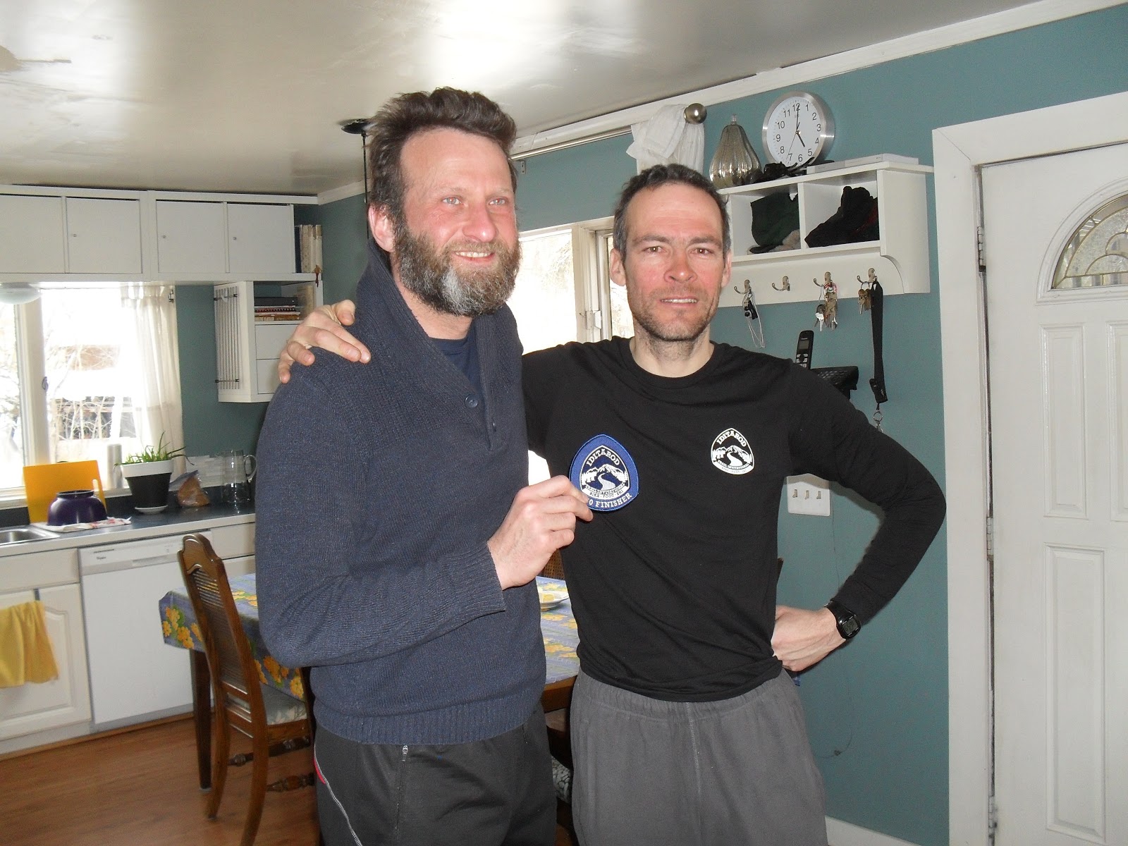
Alex and I at the finish.
I'd like to thank my family, my fellow racers, the checkers and race directors, and my co-workers and employer, all of whom made this possible and to all of whom I am deeply in debt.